What's new

Group statistics

Members:
31
Threads:
23
Messages:
273
Discussions:
1
Photos:
0

Latest posts

Latest photos

Group events

New Mexico

Save Gordy's Hill Near Socorro!

'84 Bronco II

El Chingón
Joined
May 19, 2020
Member Number
293
Messages
2,213
Loc
NM
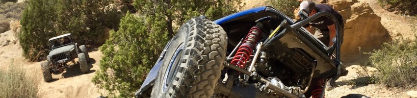
Hello everyone, I am not sure if you've seen, but the BLM is currently re-evaluating their travel plan for the Gordy's Hill OHV area just outside Socorro. In case you aren't aware, there is a lot of prime rock crawling in this area and has been the location for annual motorcycle desert races. The BLM has proposed four alternate travel plans with Alternative A being the "no action" option, and Alternatives B, C, and D having significant closures and detrimental usage re-designations.

Alternative A is by far the best option for us wheelers, so be sure to submit your comments to the BLM BEFORE the August 30th deadline. As of this post, the BLM has only received 34 comments, so it shouldn't take much to sway the comments in favor of Alternative A :beer:

Key talking points in your comments:
  • Many roads to access established rock crawling/modified 4x4 trails are arbitrarily closed or designated "single track use only" in Alternatives B,C, and D making the remaining trails in and out trails and requiring you to drive backwards against the traditional direction of travel (uphill).
  • Some closures, particularly Alternative B, will leave no legal access to trails, such as Stooges, despite those trails still being designated open to motorized use.
  • Alternatives B,C, and D close all or part of Hidden Valley which is one of the most popular modified 4x4 trails in the area.
  • All alternatives show an incorrect route for the exit of Pucker Falls which does not exist, effectively making the trail inaccessible for any Alternative other than A.
  • Many roads throughout the OHV area which are clearly established two-track roads are classified as single track in the route evaluation reports and propose to be designated for single track use only in alternatives B, C, and D.
  • Many roads are arbitrarily designated for UTV use only in Alternatives B, C, and D for no legitimate reason.
  • Many existing routes in the OHV area that have been in regular use for years have been left off all maps including Alternative A.

Comments can be submitted HERE, the BLM report and supporting documentation can be found HERE, and the full size maps of the proposed alternatives can be found HERE.

Discussion is happening in the Land Use Subforum here: BRC - Gordy’s Hill in New Mexico Releases Environmental Assessment for Public Comment on BLM Lands
 
Here's the comment I submitted. Feel free to use it to help write your own comment, but DO NOT COPY AND PASTE, paraphrase anything you would like to use in your own words :beer: I had to attach my comment as a PDF because it exceeded the character limit of the comment box on the ePlanning website :homer:

I am a frequent user of the Johnson Hill Special Recreation Management Area (SRMA) and visit with friends and family. I have guided out-of-state users and introduced several other people to the SRMA, many of whom have patronized lodgings and businesses in the community. We exclusively visit the area in modified 4x4 vehicles and enjoy the diversity and challenge of the terrain throughout the area as well as the quintessential southern New Mexico scenery. This is one of my favorite areas to visit and has a well-deserved reputation as one of the best rock-crawling locations in the state.

In the time I have been visiting the area, I have never witnessed a single conflict between user groups. In my experience, the southern and eastern portions of the SRMA are more heavily used by modified 4x4s while the northern and western portions are more heavily utilized by powersports users (motorcycle, ATV, and UTV); however, I have come across all motorized user groups throughout the SRMA. Non-motorized users seem to be a small minority and I have not seen many that stray far from the Quebradas Back Country Byway. Based on my personal experience, I do not see a legitimate need for use restrictions on two-track routes in the SRMA to avoid user conflict.

In section 1.3 (Purpose and Need) of the Johnson Hill Environmental Assessment (EA), it is stated that, “The purpose of this plan is to establish a framework that addresses current travel management and related recreation issues and improves existing recreation and OHV opportunities within the Project Area.” However, proposed Alternatives B, C, and D would drastically worsen OHV opportunities in the Project Area through seemingly arbitrary closures and use restrictions. It appears as though these proposed Alternatives were created by people who are not familiar with the established and named trails in the area and with little to no input from OHV user groups. Many of these proposed closures and use restrictions render popular, established 4x4 trails unusable due to inaccessibility and exclusion of the primary user group from the routes. Many of the route reports incorrectly classify routes as single track or “ATV Track” despite them being two track suitable for 4x4s. Examples include JH006; the portion of JH0012 between JH0007 and JH0018, which is the entrance used by 4x4s for JH0018 which is known as “Pucker Falls”; The entirety of JH0026 which is a 4x4 trail known as “Upper Amado Canyon”; the middle portion of JH0039 which is a rock crawling trail known as “Jim’s Jinx”; JH0060; JH0061 known as “Arroyo Del Coyote”; JH0070; JH085; JH0086; the majority of JH0091; JH0104; and JH0114.

Furthermore, there are rather egregious issues with the maps provided by the BLM that warrant an extension of the comment period until the BLM can rectify the issues and provide the public with accurate maps. For instance, the routes shown on the interactive online map do not match the routes shown on the PDF maps provided on the ePlanning website, and according to the legend of the Alternative A PDF, nearly all routes would be closed to motorized use despite Alternative A being the baseline/no change option. Additionally, all maps show routes that have never existed while simultaneously omitting many well-established routes that have been in use for many years.

In section 2.1.1 (Travel Management Plan Alternatives) of the Johnson Hill EA, the following statements are made: “Additionally, during Interdisciplinary Team review, some linear features were identified that are not, nor were ever, affirmed as a travel route by the BLM. BLM staff considered these linear features and determined that they were linear disturbances (see Glossary for definition); therefore, they are not included in any of the route network alternatives.” What criteria was used to classify these routes as “Linear Disturbances?” While the statement about the BLM’s affirmation of these paths as travel routes is technically true, it is rather disingenuous considering that the Johnson Hill SRMA used to have an “open” designation that permitted cross-country travel and the BLM was working in cooperation with private individuals and organizations to establish these trails that were excluded from the current maps in the EA. In fact, Mark Werkmeister, former member of the board of directors at the New Mexico Off-Highway Vehicle Alliance (NMOHVA), was approached by Mike Bilbo from the Socorro BLM office in 2004 to identify potential motorized routes in the SRMA for the purpose of designating trails within the area. Mr. Werkmeister worked with Mr. Bilbo and the New Mexico 4 Wheelers (NM4W) to map and establish these trails throughout 2004 and 2005. In fact, the NM4W club was awarded the BLM “Making a Difference” National Volunteer Award at a ceremony in Washington D.C. in May of 2005 per another Resource Management Plan written in 2008:

“The NM4W club alone logged over 2500 hours in the field during pre-development efforts at Gordy’s Hill for the Socorro office. Mike Bilbo, Recreation Planner, was so impressed with the motorized community’s efforts that he submitted an application for the BLM “Making a Difference” National Volunteer Award. The deciding committee was impressed also, and the award was granted to the NM4W and other participating motorized organizations for their work at Gordy’s Hill at a ceremony in Washington DC in May, 2005.”

Richard Rivera who served as the president of the New Mexico Tech Off Road Club (NMTORC) later worked with the BLM to re-map these same trails, so the BLM was previously aware of these routes and had given, at a minimum, implicit approval of the routes. Significant rock-crawling trails omitted from the maps in the EA include: the Arch Canyon exit, Catscratch, Corona Canyon, the Edge Canyon exit, Gates of Hell, and Granite Canyon. There were also other trails that were originally mapped by Mr. Werkmeister, but to my knowledge those have not been established.
 
continued...

Alternative A, the no action/baseline option, provides the most favorable outcome for OHV users (assuming that the red colorization of the routes on the map is a mistake). The closures and use restrictions in Alternatives B, C, and D far outweigh any perceived benefits from the proposed facility and infrastructure improvements as well as the improvements to the permit process which really only benefits event organizers and not the individual users. The only issue with the Alternative A plan as it stands is the omission of the routes mentioned in the preceding paragraph.

Alternative B, the resource protection option, is the least favorable option presented. In addition to the omitted trails, this option closes many of the most popular trails and access roads such as J0027 (The Causeway), J0030 (Lower Arroyo De Los Pinos), J0031 (Hidden Valley), JH0039 (Jim’s Jinx), JH0047 (Upper Arroyo De Los Pinos), JH0048 (Edge Canyon), and JH0125 (Bucket Canyon). In addition, the use restrictions on the section of JH0012 between JH0007 and JH0018 and JH0026 (Upper Amado Canyon) make JH0018 (Pucker Falls) inaccessible to anything other than motorcycles due to the inaccurate terminus of JH0018 that does not actually join JH0017. The closures make JH0134 (Stooges) inaccessible to OHVs of any type despite the route being designated “open.” Furthermore, the combination of closures and use restrictions make JH0024 (Bad Hair Day), JH0029 (The Great Escape), JH0129 (Doug’s Dilemma), JH0130 (Secret Canyon), JH0131 (Arch Canyon) JH0132 (Say What?!), and JH0133 (Atajo a Chupadera) all out and back trails. This doubles the impact of each vehicle on these trails and provides a much worse user experience. For instance, someone who wanted to run JH0020 (Squeeze Canyon), which has been restricted to 4x4 use, would have to drive back out JH0017, Bosquecito road, and the Quebradas Back Country Byway to reach any other trails. This Alternative also designates many routes UTV arbitrarily that can be driven by all vehicle types as well as what is currently singletrack, therefore making it two track (JH0097 for example).

Alternative C, the blended option, and Alternative D, the development option, have no meaningful difference in route designations and availability. Both Alternatives present essentially the same recreation opportunities despite the BLM’s claim that Alternative D supposedly, “emphasizes an expanded range of recreational and travel route use opportunities.” Both Alternatives close the last third of JH0031 (Hidden Valley), which is one of the most popular modified 4x4 trails in the area, and will inhibit access to other trails. This closure makes JH0031 (Hidden Valley) an out-and-back trail as well as JH0132 (Say What?!) which will double the impact of each vehicle using those trails. The access issues for JH0018 (Pucker Falls) are the same as previously mentioned for Alternative B, making the route unusable for 4x4s which is its designated use in Alternatives B, C, and D. As in Alternative B, many routes are incorrectly designated as single track, specifically the portion of JH0012 between JH0007 and JH0018, and JH0026 (Upper Amado Canyon) which is another very popular modified 4x4 trail. Similarly, as mentioned in my comments on Alternative B, there are routes designated for UTV use that are presently single track such as JH0097, or are suitable for use by all motorized vehicles (including 4x4s) such as JH0061 (Arroyo Del Coyote).

The management actions detailed in the EA are preferable in Alternative D compared to Alternative C, but development of the area does not add any value to the user experience. However, I can see where a parking area, camping facilities, and bathrooms would be attractive to powersports users (motorcycles, ATVs, and UTVs) since the sand near Competition Hill, where they typically stage from, is quite soft for tow vehicles and campers.

In summary, Alternatives B, C, and D all drastically reduce recreational opportunities for 4x4 users and would provide little to no benefit for these users compared to the current management and state of the SRMA represented in Alternative A. I believe all the issues identified in the EA can be addressed without significant closures or use restrictions of existing routes. In addition, restricting routes by user group does nothing to improve the experience of the various user groups and, in fact, would have a detrimental impact on user experiences. There seems to be no need whatsoever to restrict any route for UTV, or 4x4 use only. However, I would recommend and support the protection of existing single-track routes with use restrictions, but many 4x4 routes are presently incorrectly identified as single track in the route evaluations. An underlying issue with all the proposed Alternatives (including A) is that the BLM has erroneously classified many established routes as “linear disturbances” and excluded them from the route inventory despite documented support and collaboration from the BLM on the development and mapping of these routes. These routes should be properly mapped and added to the route inventory before proceeding with official designation of routes.

Alternatives B, C, and D are unacceptable and should be reconsidered by the BLM; Alternative D in particular since it is supposed to be the OHV-friendly alternative that should expand and improve recreational opportunities for OHV users. OHV users across the western United States are losing legal recreational opportunities at an alarming rate, especially for challenging technical rock-crawling opportunities like those prevalent in the Johnson Hill SRMA. It would be a great economic and recreational loss for the community if the BLM proceeds with Alternatives B, C, or even D. I have submitted supporting documentation with this comment.
 
Just an update from the NM4W Newsletter:

Over fifteen years ago BLM prepared an overall Resource Management Plan (RMP) for the SocorroField Office which included Johnson Hill as a special recreation management area. All of us knowthis area as “Gordy’s”. The RMP directed the Socorro Field Office to prepare a travel and recreationmanagement plan for Gordy’s.Several years prior to the RMP being prepared, one of our honorary members, Mark Werkmeister,and other club members worked with then Socorro Field Office recreation planner, Mike Bilbo, tomap out existing and future motorcycle and 4x4 trails across the area. NM4W installed a sign at theJohnson Hill staging area in Arroyo de la Parida. NM4W, NM Tech Off Road Club, and others inboth motorcycle and 4x4 communities worked to “put tracks” on the routes that were mapped.Multiple times when BLM made indications that the travel management plan was being worked on,some of our members met with BLM and provided the trail map.Fast forward to Summer 2022, BLM Socorro Field Office released the draft Johnson Hill Travel andRecreation Management Plan Environmental Assessment (EA) and opened a comment period. TheEA included three alternatives that ranged from lower levels of recreation and motorized use withemphasis on natural and cultural resource protections up to an expanded range of recreational andtravel route use with visitor service amenity development while providing required protections fornatural and cultural resources. As required, there was also a no action alternative. The EA alsoincluded maps and route reports for trails at Gordy’s.Several members of NM4W as well as local and national public land use advocacy groups reviewedthe EA including the route reports. Numerous errors were found in the route reports as well asBLM’s EA analysis. Our Historian, Frank Whiston, prepared NM4W’s comments and severalmembers submitted their own comments pointing out the errors and urging BLM to select thealternative that fully supported a meaningful motorized recreation user experience. It is important tonote that the comments submitted were based on facts and not emotional responses bemoaningpossible trail closures.This September, BLM Socorro Field Office provided NM4W with a map showing JohnsonHill/Gordy’s approved trails under the EA/recreation management plan. Other than the pipelinetrail, which is now designated as administrative use only, there were no trail closures! Almost all of 4the existing 4x4 trails were designated as “Open”. A few were designated as “Limited – 4x4 only”.The single-track trails used by motorcycles and mountain bikes also appear to have been retained.We have yet to see the final signed EA decision, but it appears BLM selected an alternative thatbenefits motorized recreation and visitor service amenity development. NM4W, Tread Lightly! andBLM Socorro Field Office continue to work on the information kiosk for the staging/parking off ofQuebradas Backcountry Byway. Future plans include grading/leveling the staging/parking area.As your President, and user of the Gordy’s area, I am grateful for the numerous hours our membersand others devoted to analyzing the EA and providing comments to BLM. Based on the approvedmap; route report errors appear to have been corrected and comments regarding route designationchanges have been incorporated.
 
Lol, the comment in the middle about the rest of the comments being emotional about trail closures is adorable. What else is there for an average joe to discuss?
 
Sorry for the wall of text; the formatting was lost when I copied and pasted.

This came from page 3 of the October NM4W Newsletter

I am not sure what "almost all of the existing 4x4 trails were designated as 'Open'" means, but Jack also said Pipeline road was the only one that closed :confused:
 
On a different note, friends of mine setting up this month's dirt bike race in Socorro seem to have noted that the new travel management plan opened up more options for them to run different spots for the race.

Do we users have access to the new map of routes on the blm site? '84 Bronco II
 
Last edited:
Top Back Refresh