What's new

Oregon wheeling while dodging fires.

Drakeslayer

Wet Trail Wheeler
Joined
May 19, 2020
Member Number
257
Messages
186
Loc
Southern Oregon Coast
The kids are taking Mrs. Drakeslayer to Hawaii for three weeks starting August 13. I had planned a wheeling trip to eastern oregon's desert region but it's on fire. Looking for firsthand smoke and fire info. Anyone know if the off road vehicle area east of Prineville is open or full of smoke? I'm thinking I may have to go up the coast to Tillamook State Forest instead. I haven't been up there so that is a plus as checking out new to me areas is good. Anyone know about Browns Camp? I think that's what it's called. Any particular equipment needed for that area? I have a YJ, SOA on 35s with lockers, winch. I have bigger Irok TSLs but I will probably leave them home as the jeep doesn't tow at highway speeds with them very well. I carry the usual self recovery gear and survival stuff.
 
I just drove from rubicon through Warren Oregon smoke was bad but I cut over to Eugene so not that far north. Nothing on the west side as far as smoke.

Browns camp last I knew was closed because of fire danger. Wheeling season is getting smaller every year.
 
From my shoddy memory of the one time I went to Tillamook to wheel you'll have fun with your Jeep. :flipoff2:

Also leaving for Bend on Sat and it's looking pretty grim for anything outdoors. :mad3:

 
Iroks and TSLs are 2 completely different tires. Do you have Iroks or TSLs?
 
I stay home in active fire areas. Yeah I know lame but I've been in the woods wheeling when fire smoke rolled it. There are few times I can remember being seriously sacred and that was one of them. Can't see crap, no idea if it's a mile or 15 away.
 
I stay home in active fire areas. Yeah I know lame but I've been in the woods wheeling when fire smoke rolled it. There are few times I can remember being seriously sacred and that was one of them. Can't see crap, no idea if it's a mile or 15 away.
I agree, that's why I'm trying to find out more info about the areas I had originally planned to wheel. I realize things could change in the weeks ahead but whatever I can find out may be helpful.
 
I was just in Sunriver for a week, got back Saturday, hit a small forest road one day near the lava caves off 97

Smoke was annoying most of the week, but more as an irritant and not so much blocking vision. One of the worst days I started to see occasional ash falling.

As mentioned above, I wouldn’t really want to mess around near there with active fires as many as there are
 
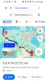
No idea what I did but somehow opening this thread made my.phone open a Google maps program with how to drive to Marshallton Iowa. Wtf?
 

Attachments

  • Screenshot_20240729-123807_Maps.jpg
    Screenshot_20240729-123807_Maps.jpg
    891 KB · Views: 3
Spent last night in Bend, smoke was bad coming up 97 especially near La Pine. Went to the High Desert Museum this morning and it rained some which helped with the smoke and will hopefully help knock the fires down some.
 
I agree, that's why I'm trying to find out more info about the areas I had originally planned to wheel. I realize things could change in the weeks ahead but whatever I can find out may be helpful.

I use the weather App Windy, it has an active fire layer that you can turn on to show where the fires are at generally. It's pretty up to date but not like up to the minutes, maybe for the day accurate.

1722285986973.png
 
205 views and one response, you mothfockles don't wheel do you?
You posted on the weekend, the wheelers were in the woods. :flipoff2:

Brown's Camp is currently open. It does close late in the season for fire at times but it is raining today so you have to just kind of keep an eye on it.

I could probably be convinced to play guide up there if you wanted one. my weekends are pretty full this month already but I could probably make a day trip during the week. I'm about 45 minutes away.
 
In Washington the first week in July is the week to go. I can't imagine E Oregon is any different
You still have some snow drifts you will have to punch through up high, and the fires are still just getting rolling in the lower lands
But in the big picture you can still navigate how you wish

But fires can move fast, I don't mess with them and try to get as many roads/rivers between me and them as possible as quickly as I can
 
What area is east of prineville that has wheeling? Cline, rim, and hoodoo are all open. Ray Benson sno park is closed to allow fire fighters to stage but here is day use parking for hoodoo/quack attack
 
Central OR got some rain last night and cleared the smoke up some for now.
 
I'm starting a new project in La Pine, I'll be there Sunday the 11th. I can give you an update if you like.
 
Top Back Refresh